VMF Data Server

Vienna Mapping Functions Open Access Data

The VMF Data Server provides a portfolio of tropospheric products and forms a source of consistent troposphere delays models for all space geodetic techniques. The products include mapping functions, such as the widely used VMF1, but also ray-traced delays for VLBI observations as well as corrections for atmospheric pressure loading.
Please view our Products page for further details.

We would like to express our gratitude to the Austrian Science Fund (FWF), who funded the project to set up this data server (ORD-68), as well as to the European Centre for Medium-Range Weather Forecasts (ECMWF) for providing Numerical Weather Model (NWM) products.

Please read our Terms of Use.

Cite as: re3data.org: VMF Data Server; editing status 2020-12-14; re3data.org - Registry of Research Data Repositories. http://doi.org/10.17616/R3RD2H
Data Access

Publications

Latest Data at Wettzell (Germany)

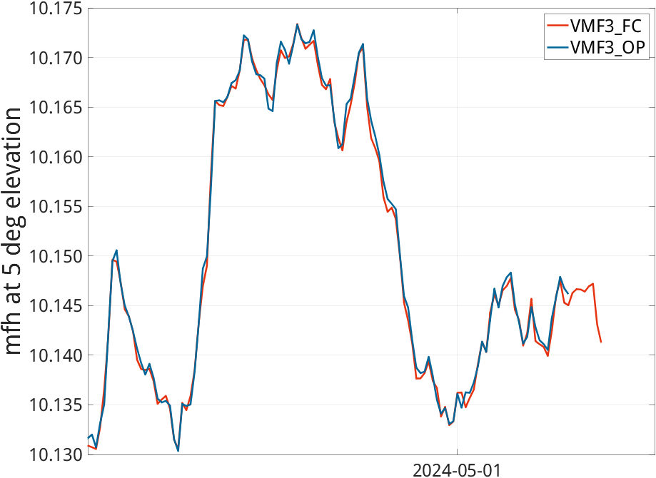
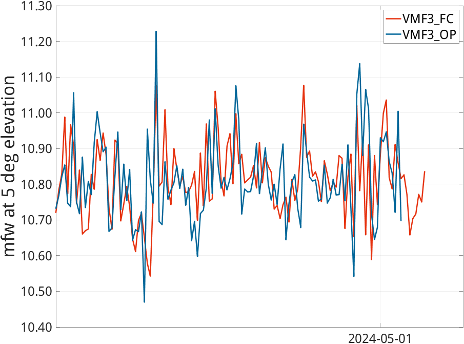
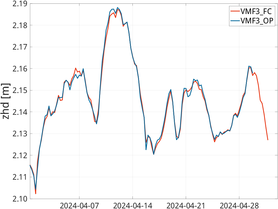
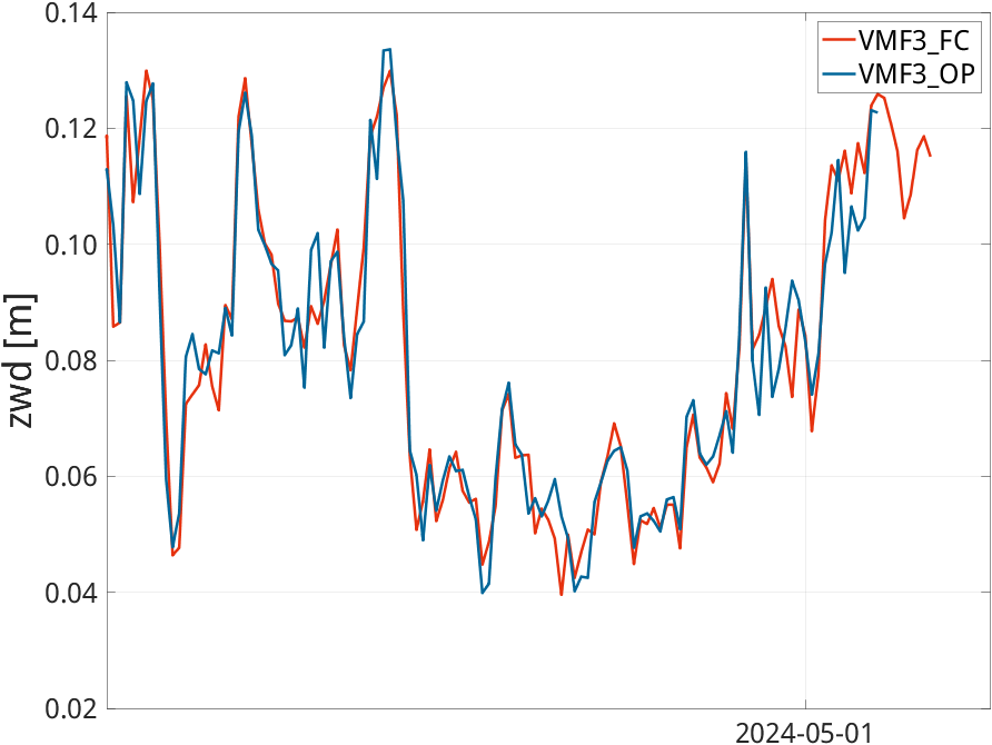
The charts below illustrate the comparison of two different versions of VMF3 parameters at the Geodetic Observatory Wettzell in Germany over the last four weeks.
VMF3 parameters derived from operational Numerical Weather Models are depicted in blue (VMF3_OP), those derived from forecast Numerical Weather Models are depicted in red (VMF_FC). The top left chart refers to the zenith hydrostatic delay (zhd), the top right to the zenith wet delay (zwd), the bottom left chart refers to the hydrostatic mapping factor (mfh), and the bottom right to the wet mapping factor (mfw). Both mapping factors are calculated for an elevation angle of 5 degrees.

Partners

TU Geodesy Logo BEV Logo FWF Logo re3data Logo

Contact

vmf@tuwien.ac.at

Johannes Böhm
Research Division Higher Geodesy
Department of Geodesy and Geoinformation
TU Wien
Wiedner Hauptstraße 8, 1040 Vienna, Austria

Janina Boisits
Satellite Positioning with GNSS and APOS
Department for Control Survey
Federal Office of Metrology and Surveying
Schiffamtsgasse 1-3, 1020 Vienna, Austria